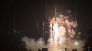
 In this Nov 19, 2018 file photo, China sends two new satellites of the BeiDou Navigation Satellite System (BDS) into space on a Long March-3B carrier rocket from the Xichang Satellite Launch Center in southwest China's Sichuan province. (JU ZHENHUA / XINHUA)
BEIJING - China's BeiDou Navigation Satellite System (BDS) has remarkably enhanced the country's comprehensive traffic management in both efficiency and safety, according to the latest report.
The BDS and related technologies have been extensively applied in all major fields in China's transportation sector, said the report on the construction and development of the BDS released by the China Satellite Navigation Office.
By the end of October, around seven million commercial road vehicles had been installed with the BDS, accounting for 96 percent of road vehicles in operation
The BDS has been applied in many areas such as key transportation process monitoring, highway infrastructure safety monitoring, port high-precision real-time positioning and dispatching monitoring, said the report.
READ MORE: China's last BDS satellite enters long-term operation mode
By the end of October, around seven million commercial road vehicles had been installed with the BDS, accounting for 96 percent of road vehicles in operation.
A total of 31,400 postal and express delivery vehicles have also applied the BDS, around 88 percent of the total sum, according to the report.
Around 1,400 public service boats and ships, 75 percent of the total sum, have been equipped with the BDS.
It has also been installed on about 300 general aircraft, accounting for 11 percent of the total sum, according to the report.
ALSO READ: BDS-3 gains major breakthrough in civil aviation sector
China declared the official commissioning of the BDS on July 31, marking the formal opening of the BDS-3 system for global users.
Along with positioning, navigation and timing services, the BDS-3 system can also provide a variety of value-added services like assistance in global search and rescue, short message communication, ground-based and satellite-based augmentation, as well as precise point positioning.


