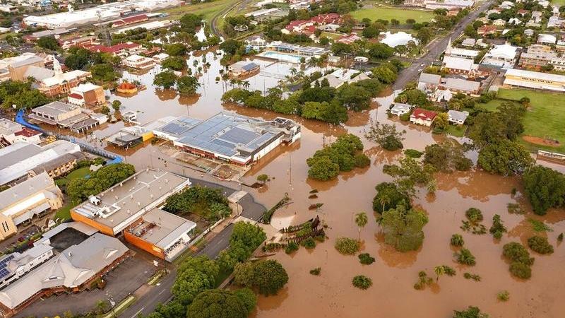
 In this photo provided by the Fraser Coast Regional Council, water floods streets and buildings in Maryborough, Australia, Feb 28, 2022. (QUEENSLAND FIRE AND EMERGENCY SERVICES VIA AP)
SYDNEY — After one of the wettest years on record, Australia's weather forecaster says a La Nina weather pattern, associated with wet weather, is slowly weakening, although a separate weather system will keep the odds of rain high until mid-January.
Record rainfall caused waves of severe flooding across Australia in 2022. Floods in March and October displaced tens of thousands along the populous east coast. Sydney recorded its wettest year in 164 years.
Long-range forecasts suggest that tropical Pacific Ocean temperatures will continue to warm towards El Nino-Southern Oscillation neutral levels over the coming weeks
The Bureau of Meteorology in September declared a rare third consecutive annual La Nina event, known for producing wet and windy summers.
READ MORE: EU report: Europe suffered year of climate chaos in 2021
But a new climate model published on Wednesday suggested La Nina will ease over the southern hemisphere summer as the Pacific Ocean warms.
"Long-range forecasts suggest that tropical Pacific Ocean temperatures will continue to warm towards El Nino-Southern Oscillation neutral levels over the coming weeks," the forecaster said.
Above average rainfall is more likely until at least mid-January because a separate weather system, the Southern Annular Mode, will remain strongly positive until then. It is associated with above-average rains across the southeast.
READ MORE: We need to prepare to deal with more heat waves
Wet weather continues to play havoc with the Pacific nation. Prime Minister Anthony Albanese on Tuesday announced A$126 million ($85.67 million) in support for parts of South Australia state hit by floods over Christmas.
Sea surface temperatures remain warmer than average in the Western Pacific and around northern Australia, the forecaster added, which can result in greater humidity and rainfall.


