
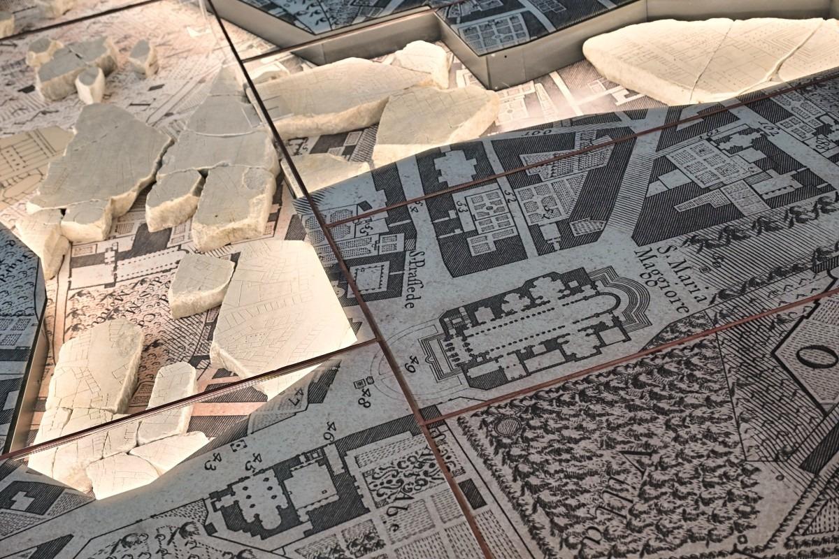
 This photo shows the details of the original marble map of the ancient Rome "Forma Urbis Roma" at the new Museum della Forma Urbis, during the opening of the Archaeological Park of Celio, on Jan 11, 2024. (PHOTO / AFP)
ROME - A marble map of ancient Rome, that hasn't been put on public view for almost 100 years, is getting its very own museum within sight of the Colosseum.
The Museum of the Forma Urbis, enclosed within a new archaeological park on one of Rome's famous seven hills opens on Friday - the latest offering from a city that is eager to broaden its attraction for growing hordes of tourists.
"This is a beautiful day. We are opening an archaeological park in an extraordinary part of the city and a new museum showcasing a masterpiece which has not been visible for about a century," said Rome Mayor Roberto Gualtieri.
"We want a city where the museums and the streets are linked, and where people, while walking around, can fully appreciate and enjoy the beauty, but also better understand how our city has been transformed."
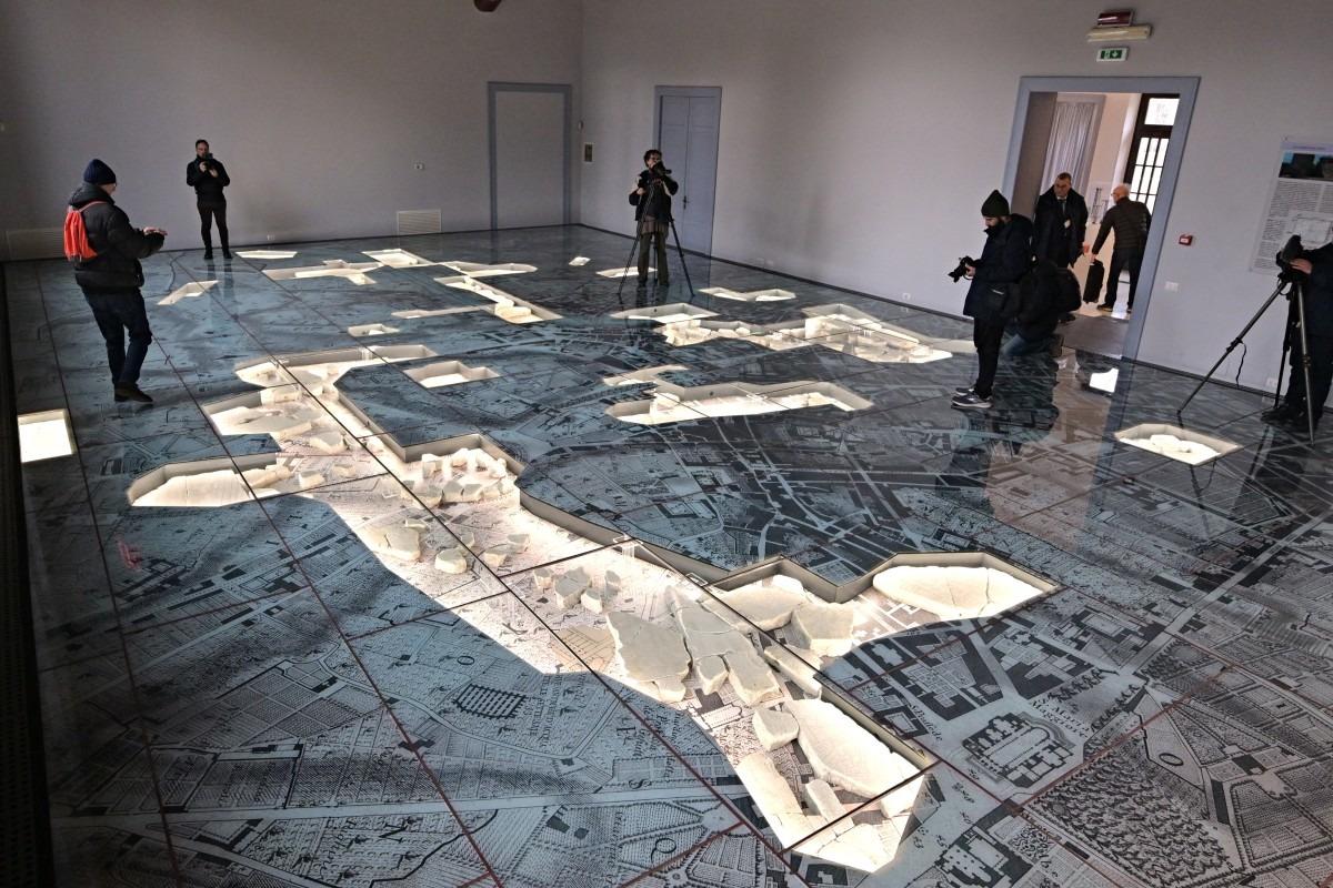 Journalists look at the original marble map of the Ancient Rome "Forma Urbis Roma" at the new Museum della Forma Urbis, during the opening of the Archaeological Park of Celio, on Jan 11, 2024. (PHOTO / AFP)
The Forma Urbis was a monumental, highly detailed marble map of ancient Rome carved during the reign of the Emperor Septimius Severus between 203 and 211 AD, engraved onto 150 separate slabs and measuring 18 by 13 meters.
It was displayed on a wall in the ancient city, but over the centuries it gradually disintegrated, with locals using some slabs for new buildings.
ALSO READ: New find sheds light on Ancient Rome's Pompeii slaves' life
During excavations in 1562, fragments were recovered and scholars estimate around 10 percent of the whole has survived, including sections showing the Colosseum and Circus Maximus, as well as floor plans of baths, temples and private houses.
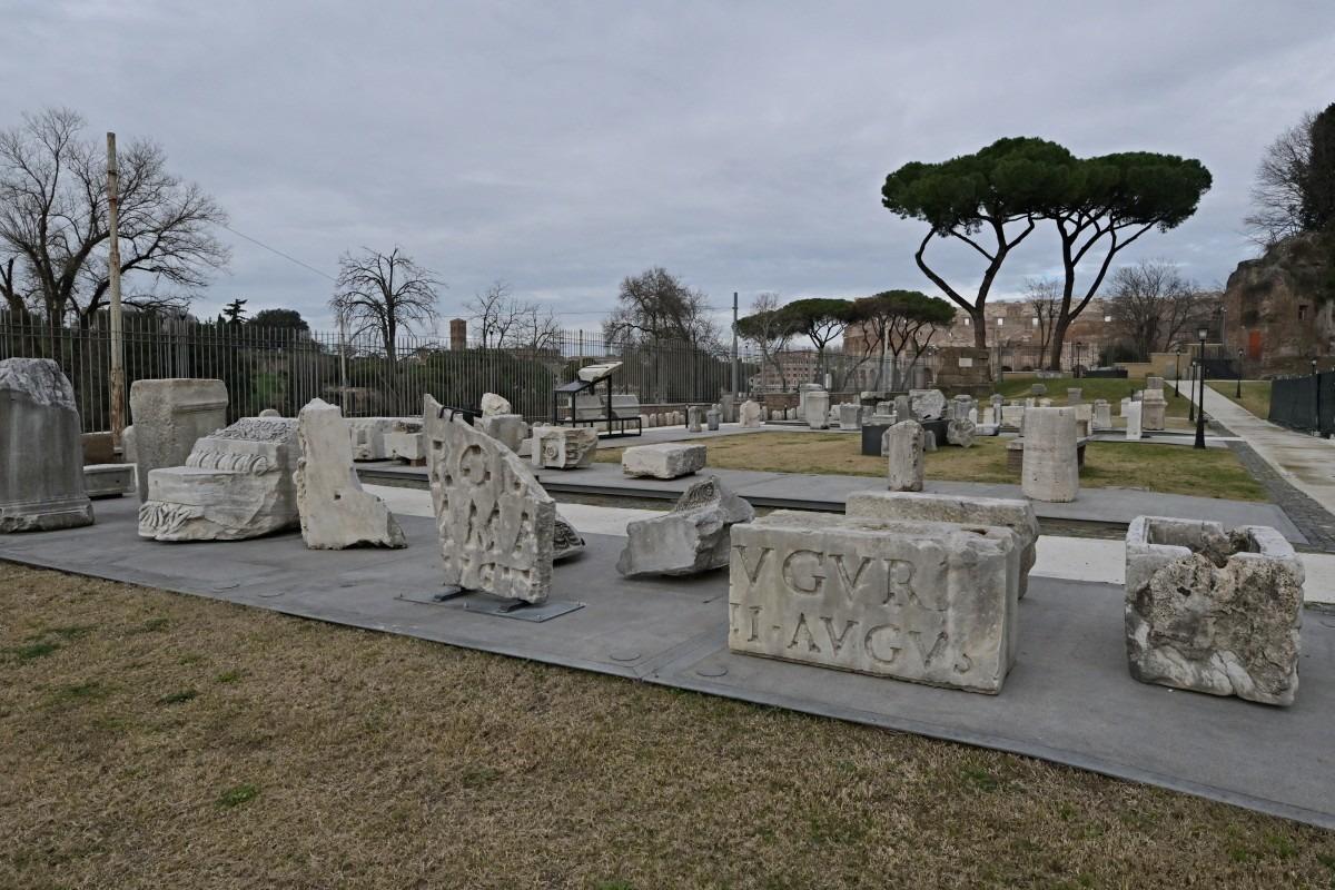 Carved marble blocks from the Ancient Rome are lined up during the opening of the Archaeological Park of Celio and Museum of Forma Urbis, on Jan 11, 2024. (PHOTO / AFP)
The huge carving has proved a valuable resource for understanding the layout of ancient Rome, but all the remaining pieces have not been shown together since 1924.
In its new, innovative setting, the fragments have been laid out on a reproduction of a famous map of Rome created in the 18th century by the surveyor Giovanni Battista Nolli, who is credited with making the first accurate street plan of Rome.
The marble chunks lie on top of the Nolli map, showing their relation to the developing Renaissance city.
Outside the museum, in the open-air park on the side of the Caelian Hill, archaeologists have out laid out walkways lined with ancient Roman grave markers and marble columns found in excavations around the city in recent decades.
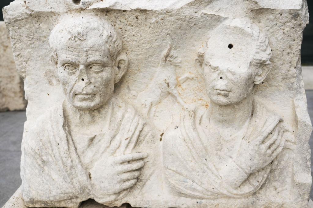 Archeological findings of the Roman Empire are displayed in the Park of Mount Celio Museum overlooking the Colosseum where is kept the giant marble map (Forma Urbis Romae) of the ancient Rome on Jan 11, 2024. (PHOTO / AP)
"The Caelian Hill, one of the seven hills of ancient Rome, has remained in the shadows, unknown and inaccessible for a very long time. Today, we are finally giving it back to the city," said Claudio Parisi Presicce, who oversees Rome's cultural heritage.
"The hill has a special importance because it is what unites the monumental area of the Imperial Forums, the Roman forum, the Colosseum and the area of the Appia Antica," he said.
READ MORE: Rome to open ancient square where Julius Caesar was killed
The 5-million-euro ($5.5 million) project is part of a broader refurbishment of Rome, which has seen a tourism boom since the end of the COVID-19 pandemic and is expected to be submerged by visitors in the 2025 Roman Catholic Holy Year.