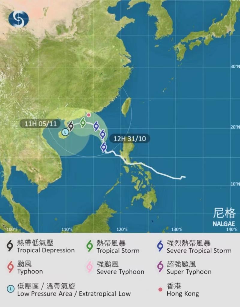
 This screengrab taken from the official website of the Hong Kong Observatory on Oct 31, 2022 shows the forecast track of Severe Tropical Storm Nalgae.
HONG KONG – The Hong Kong Observatory on Monday afternoon raised the typhoon signal No 3 as Severe Tropical Storm Nalgae edged closer to the city.
In a weather bulletin, the HKO said the Strong Wind Signal, No 3 will remain in force at least until noon Tuesday as Nalgae moved steadily closer to the northern part of the South China Sea.
As of 4 pm, Nalgae was estimated to be about 630 kilometers south-southeast of Hong Kong was forecast to move north-northwest at about 10 kilometers per hour
“Under the combined effect of Nalgae and the northeast monsoon, strong winds are expected to prevail generally over the territory tonight and tomorrow morning, with occasional gales on high ground,” the HKO said.
ALSO READ: HKO issues typhoon signal No 1 as Nalgae nears Hong Kong
“The Observatory will closely monitor (Nalgae’s) movement and development, and assess the need of issuing a higher signal,” it added.
As of 4 pm, Nalgae was estimated to be about 630 kilometers south-southeast of Hong Kong was forecast to move north-northwest at about 10 kilometers per hour towards the northern part of the South China Sea.
The HKO said seas were rough with swells and advised members of the public to stay away from the shoreline and not to engage in water sports
READ MORE: HKO: Hong Kong's September dry and exceptionally hot
With the typhoon signal No 3 in force, classes in kindergartens, schools for children with physical or intellectual disability are suspended today, the Education Bureau said in a statement.
However, these schools should keep their premises open and implement contingency measures to look after arriving students. They should ensure that conditions are safe before allowing students to go home, the bureau added.


