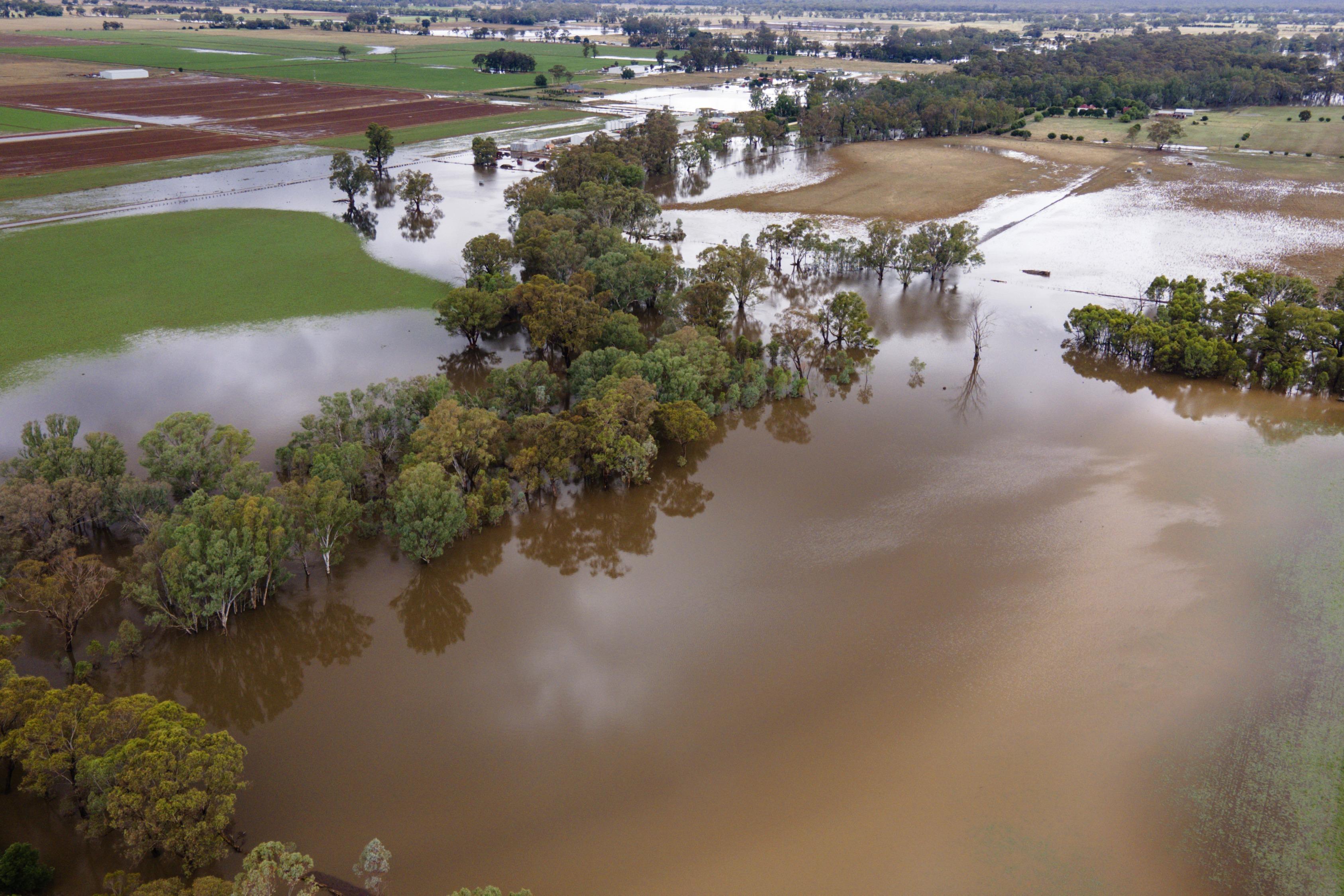
Torrential rains during the summer season heighten concerns about climate change and its fallout
 Farm land is flooded near Bendigo, Australia, Jan 8, 2024. (PHOTO / AP)
Australians were warned by scientists to brace themselves for a long, hot, and very dry summer due to the El Nino effect in the second half of last year.
Between August and October, the predictions seemed to be on track with record heat waves from Western Australia to the nation’s east coast along with bushfires.
Come November all that started to change with violent storms and floods from Cape York in far north Queensland to the southern states of New South Wales (NSW) and Victoria.
And early this year, towns such as Broken Hill in far western NSW had more than half a year’s rain in just two days (Jan 6-7), the biggest deluge in 63 years.
So, what happened to the much hyped El Nino?
ALSO READ: Flooding hits southeast Australia as heavy storms drench region
David Karoly, professor emeritus at the University of Melbourne’s School of Geography, Earth and Atmospheric Sciences, said: “It’s a question a lot of people are trying to seek an answer for.”
He said the weather extremes this summer in Australia were not typical of an El Nino event.
“It’s unclear why that is,” he told China Daily.
He said weather conditions in November and January along the NSW and Queensland coasts are not typical for El Nino, which features conditions usually dry and hotter than normal.
“Yes, it’s been hot in December but wetter than is typical for El Nino,” he said.
“Despite the wet conditions, climate change and global warming has meant that the maximum temperatures have been above normal in southeast Queensland and northern NSW coast, and above average almost everywhere else.
“As for the cause … we don’t know.”
 Royal Australian Navy personnel work with civilian emergency services to evacuate members of the public in Cairns, Australia, Dec 18, 2023. (PHOTO / AUSTRALIAN
DEFENSE DEPT VIA AP)
Agus Santoso, adjunct fellow with the University of New South Wales’ Climate Change Research Centre, said: “El Nino is usually associated with hot /dry weather. This was the case in Australia in the run up to December but then we have had a series of storms and torrential rain fall along the east coast of the country,” he told China Daily.
“It is not the type of weather generally associated with El Nino.”
Australia’s Bureau of Meteorology declared the El Nino in September, three months after the National Oceanic and Atmospheric Administration in the US and two months after the UN’s World Meteorological Agency
“The impact of El Nino in the Southern Hemisphere is more pronounced during winter and spring and is associated with hot and dry condition over Australia. This typically tends to precondition a drier and hotter summer as well, because there would be less moisture on land available for evaporation and precipitation,” he said.
Santoso added that “El Nino also tends to coincide with the northward displacement of the roaring forties towards southern parts of Australia, corresponding to the negative phase of the Southern Annular Mode. This brings dry air from inland into the east coast, not rain”.
“However, recently the Southern Annular Mode has been in a positive state, so there is more moisture coming from the ocean towards the east coast. In addition, the water off the east coast has been unusually warm, which is conducive for storms formation.”
He said there are factors, however, that can override the El Nino impact, especially in summer, delivering wet conditions instead.
The Southern Annual Mode refers to the dominant atmospheric variability mode in the Southern Hemisphere that influences climate and weather conditions in Antarctica and nations such as New Zealand and Australia.
“A warmer atmosphere is also able to hold more moisture, and so it is possible that in the future we see even heavier rainfall even when there is an El Nino,” said Santoso, adding: “We also need to keep in mind that the impact of El Nino can differ from event to event, but in general it is associated with a drier Australia.”
ALSO READ: Australians assess flood damages from cyclone, rescue ramps up
Australia’s Bureau of Meteorology declared the El Nino in September, three months after the National Oceanic and Atmospheric Administration in the US and two months after the UN’s World Meteorological Agency.
Back in August a senior weather scientist with the bureau said Australians should prepare for a summer of heatwaves.
On Aug 25, Karl Braganza, the bureau’s national manager for climate services, was quoted by Guardian Australia as saying that the year “could be significant in terms of heatwaves and fires”.
He said the record-breaking heat in the world’s oceans could be one reason behind the failure of El Nino to form so far.
“Historically we have not seen a situation like this before going into an El Nino event with record global ocean temperatures,” he told Guardian Australia.
So, is it becoming harder to make accurate forecasts?
Professor Emeritus Karoly from the University of Melbourne thinks not.
“Europe has seen major heatwaves last summer and now it is experiencing a severe cold spell. But that is not unusual for winter in Europe,” he noted.
“What we are seeing are people getting used to warmer conditions and forgetting what temperatures use to be like. It is the same here in Australia. Warmer temperatures are becoming more frequent and cooler conditions less frequent.”


