
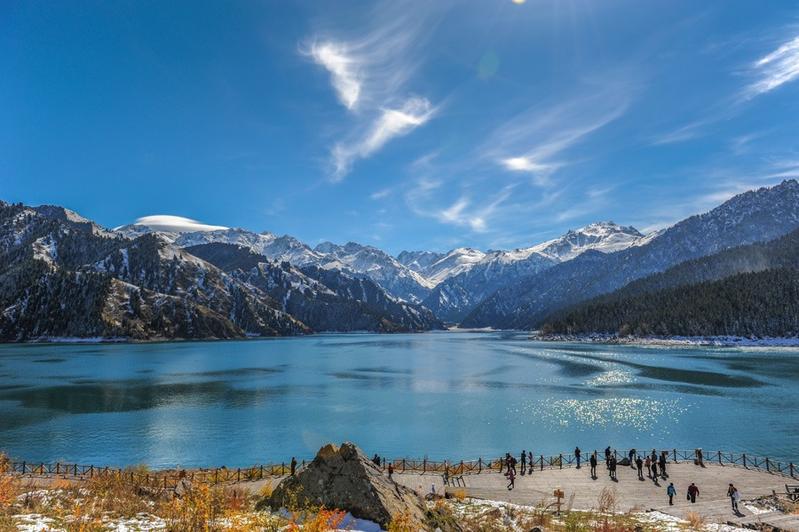
 The Ministry of Culture and Tourism and the State Council's poverty alleviation office launch a tourism loop connecting the poor regions of western China, including Tibet, Xinjiang, Sichuan, Yunnan, Gansu and Qinghai. (PHOTO / ZENG YUTIAN)
A tourism loop connecting the poor regions of western China has been launched in a bid to help locals to get out of poverty, while offering travelers primitive natural beauty and distinctive, folky charm.
The country's rural tourism income hit US$119.6b in the first half of last year, accounting for 31.4% of the domestic tourism revenue, the Ministry of Culture and Tourism reports
The loop runs for roughly 11,000 kilometers and covers Tibet and Xinjiang Uygur autonomous regions, Sichuan, Yunnan, Gansu and Qinghai provinces.
The initiative was launched by the Ministry of Culture and Tourism and the State Council's poverty alleviation office in early January.
More than 80 percent of the area within the loop sits on the Qinghai-Tibet Plateau, and remains underdeveloped, a government official says.
Yet, the area features splendid natural landscapes, including oases, the Gobi Desert and alpine landforms, as well as being home to a diverse folk culture.
Four routes along the loop have been launched to satisfy travelers' different needs.
The northwest part of the loop offers elements of the ancient Silk Road and runs from Gansu province's capital Lanzhou, across the Hexi Corridor, to Xinjiang's Kashgar.
Travelers would see the mountains of Qilian, Tianshan and Kunlun, the Junggar and Tarim basins, and the Taklimakan Desert. The Mogao Grottoes and Jiayu Pass in Gansu, as well as Huoyan (Flaming) Mountain, Tianchi Lake and Grand Bazaar in Xinjiang are all sites on the route that one shouldn't miss. In addition, areas of the Gobi Desert, lakes, danxia (red sandstone characterized by steep cliffs) and yardang (dry areas with wind erosion landscape) landforms can also be seen along the route, which is suitable for travel all year round.
 (PHOTO / CHEN HUI)
The loop's southern section boasts adventurous experiences. It departs from Kashgar, climbs up nearly 5,000 meters into Ngari prefecture in Tibet, and then leads to Tibet's capital, Lhasa, after traveling across the Himalayas, Gangdise Mountains and the Yarlung Zangbo River.
ALSO READ: Winter tourism visitor numbers set to soar
The Xinjiang-Tibet Highway, Qomolangma (Mount Everest) and Yarlung Zangbo Grand Canyon, each among the highest, tallest and grandest of their kinds, are studded along the southern route, along with world-class cultural heritage sites, including the Potala Palace, Jokhang Temple and Norbulingka Summer Palace in Tibet. Travelers will enjoy Tibetan folk operas and art featuring fragrance and paper making, as well as festive celebrations. The route also meanders along borders between Tibet and India, Nepal and Bhutan.
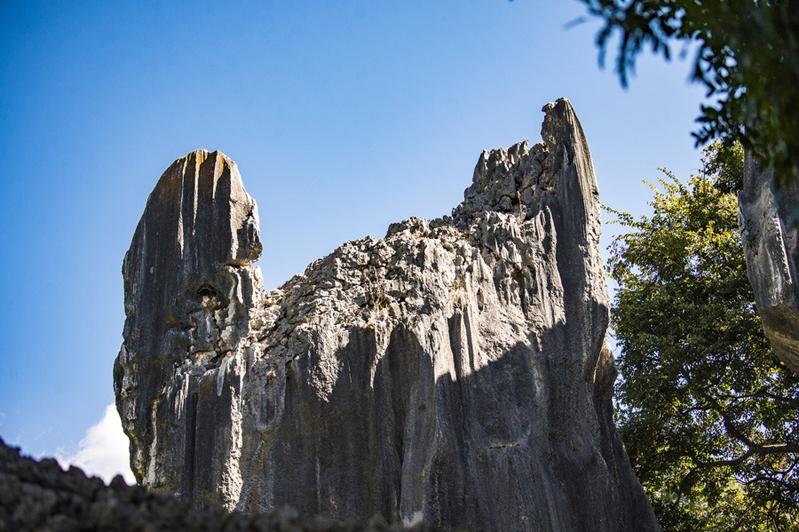
The southeastern part of the loop encourages one to seek out the heritage of the Tea Horse Road, also known as the Southern Silk Road. An ancient trade route, it was used to transport tea and goods, such as aromatic beverages, between Sichuan and Yunnan province and Tibet a thousand years ago.
The route runs between Yunnan's Kunming and Tibet's Lhasa, across the Himalayan and Hengduan Mountains, as well as the Yarlung Zangbo, Jinsha and Lancang rivers. It takes travelers down through valley and alpine scenery and allows them to enjoy primitive forests and roaring rivers during the trip. The holy towers in Yunnan's Dali and temples in Tibet have never failed to pack in pious visitors, while the surviving ancient courier stations along the route hint at how people moved from self-sustaining to a goods exchange-based economy.
 (PHOTO / SUN CHANGSHAN)
The eastern section is the shortest of all that comprise the loop, yet it is home to a multitude of world-class landscape scenery and profound culture and history. The route runs across Sichuan before entering Gansu, and ends in Gansu's capital Lanzhou.
It presents idyllic beauty, with prairies, forests, glaciers, snow mountains and valleys, with an altitude gap of around 4,000 meters.
To date, Alibaba's mapping unit, AutoNavi Software Co, also known as Gaode Map, has launched a mobile phone-based guidance for self-driving excursions and the locations of major scenic spots on the loop.
The map will recommend the best means of transportation and navigation for travelers on the loop, while information on dining, accommodation, recreation and shopping along the routes is readily accessible. Moreover, drugstores, gas stations and toilets are also highlighted.
Gaode Map's involvement is in response to the national rural revitalization strategy, launched by the government last year.
 (PHOTO / SUN ZHIJUN)
A total of 17 government departments, including the National Development and Reform Commission, jointly launched a three-year action plan and guidance on improving rural tourism infrastructure, service and financing, as well as boosting sustainable rural tourism development.
The goal is to highlight elements of agriculture and scenery and help rural residents to increase income.
The strategy has been a shot in the arm for rural tourism development.
The country's rural tourism income hit 770 billion yuan (US$119.6 billion) in the first half of last year, accounting for 31.4 percent of the domestic tourism revenue, the Ministry of Culture and Tourism reports.
READ MORE: Tourism to mainland holds steady
 (PHOTO / CHINA DAILY)
Travelers made nearly 1.4 billion visits to rural areas, representing 48.6 percent of total domestic tourism.
Gaode Map hopes its service will entice more travelers to the west and help tourism resources in poor regions turn into economic growth, according to Liu Zhenfei, president of the mapping company.
Liu says he hopes the company will help drive its users to underdeveloped areas with rich culture and tourism resources and help realize the sustainable development of rural tourism.