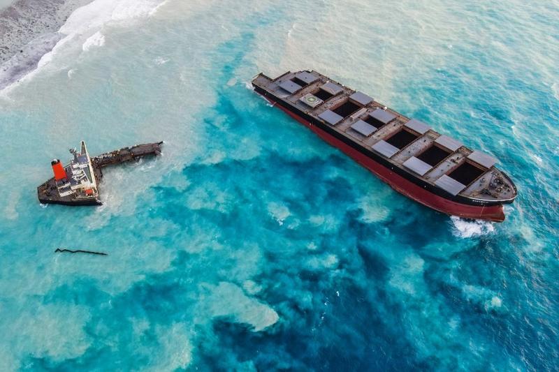
 An aerial view taken in Mauritius on August 17, 2020, shows the MV Wakashio bulk carrier, belonging to a Japanese company but Panamanian-flagged, that had run aground and broke into two parts near Blue Bay Marine Park.
(PHOTO / AFP)
TOKYO - The Japanese-owned bulk carrier that ran aground off Mauritius and spilled oil over pristine waters and fragile coral reefs diverted more than 100 kilometers from a regular shipping lane, data from a maritime analysis firm showed.
The MV Wakashio, owned by Nagashiki Shipping and chartered by Mitsui OSK Lines Ltd, struck a coral reef on Mauritius’s southeast coast on July 25 and later began leaking oil. Two of the ship’s officers have since been arrested on charges of endangering safe navigation
The MV Wakashio, owned by Nagashiki Shipping and chartered by Mitsui OSK Lines Ltd, struck a coral reef on Mauritius’s southeast coast on July 25 and later began leaking oil. Two of the ship’s officers have since been arrested on charges of endangering safe navigation.
ALSO READ: Mauritius arrests captain of stricken Japanese oil tanker
The iron-ore carrier was using a well-travelled shipping lane that passes near Mauritius when the accident happened, according to maritime analysis firm Windward and shipping sources.
It appears to have deviated from that lane about 55 nautical miles (102 km) from Mauritius and headed straight for the Indian Ocean island, the data showed. The data shows the ship’s track during the last few hours of its journey, including a minor turn after crossing into Mauritius’ territorial waters.
“It was on a very bad trajectory,” Omer Primor, Windward’s head of marketing, told Reuters.
It was not immediately clear why the ship appeared to deviate from its course. Tracking data for other cargo vessels passing close to Mauritius recently show them all sticking to the shipping lane.
ALSO READ: Mauritius seeks compensation after vessel blackens beaches
The Mauritius coast guard had repeatedly tried to reach the ship to warn it that its course was dangerous but received no reply, Reuters reported this week.
When asked about the Windward data, a Nagashiki Shipping spokesman said: “We have submitted our route record data to the police, but we cannot comment on the data, as the police are investigating the incident”.
The company has declined to comment on the report that the coast guard had tried to contact the ship. A spokesman at Mitsui OSK, which chartered the ship, said it was also investigating the carrier’s course. He declined to comment further.
One regional maritime official said Automatic Identification Systems (AIS) data he had seen did not show the ship’s turn inside Mauritius’ territorial waters, but added that it could be because of an inaccuracy in AIS data.
READ MORE: Japanese ship involved in Mauritius oil spill breaks apart
The government of Mauritius and maritime authorities there did not immediately respond to a request for comment on the data.
Mauritius said on Thursday it has started to scuttle the ship, after announcing the plan a day earlier, which had raised alarm from environmentalists worried about further damage after more than 1,000 tons of fuel oil leaked.
Scientists say that the full impact of the spill is still unfolding but that the damage could affect Mauritius and its tourism-dependent economy for decades.
The wildlife at risk include the seagrasses blanketing sand in the shallow waters, clownfish living in coral reefs, mangroves systems, and the critically endangered Pink Pigeon, endemic to the island.


